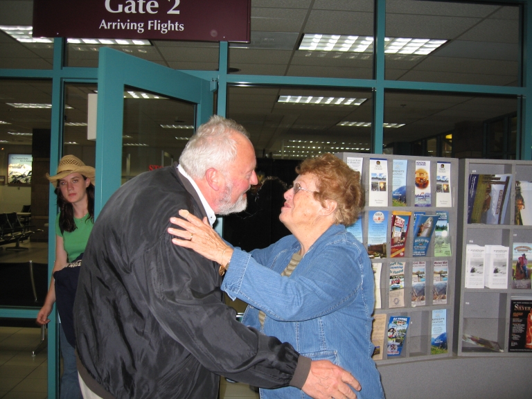
 A late arrival! Gerhard's plane connections were too tight in Denver, so he came in on the last plane to Montrose. We met him around 9:30 p.m., I think it was.
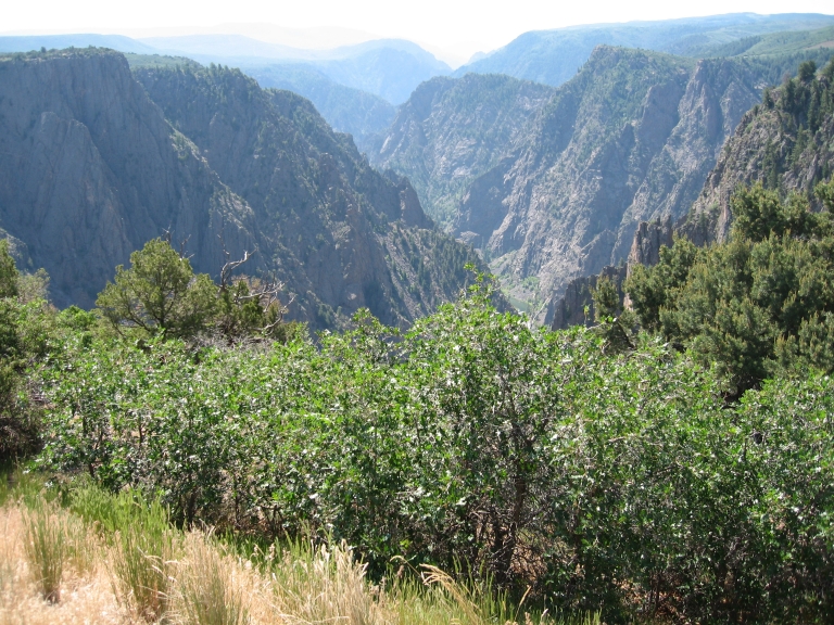 Panorama.
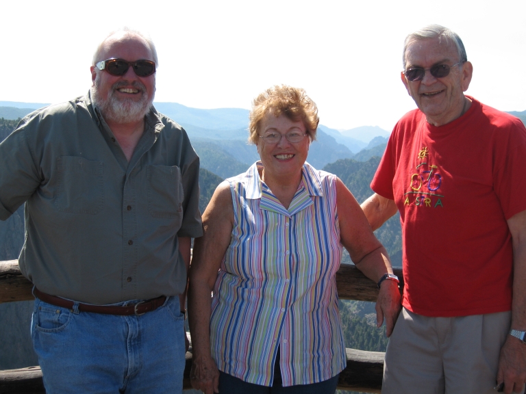 The explorers on the first day
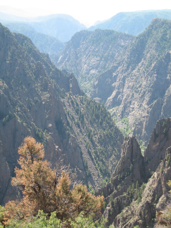
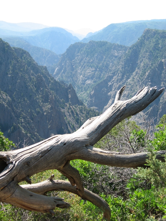 Panorama with dead tree trunk
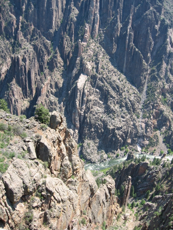
 Sheer drop
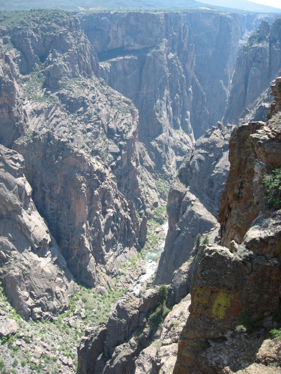
 At the bottom of the canyon, the Gunnison River.
From the sign at this lookout: "Swift water of the Gunnison River and abrasion from the sediment are the chief cutting tools in the deepening of Black Canyon, but there are other forces important to the carving of the canyon. Moisture entering joints and fractures promotes weathering. As the fractures slowly widen, large rock masses are gradually weakened to the point where they slide or tumble to the canyon floor.
Look up the canyon to your right. The south rim (to your right) has eroded back farther than the north (to your left). The south rim faces north so it does not receive as much sun and does not dry out as quickly as the north rim. since moisture is an important factor in erosion, a moist slope will tend to erode at a faster rate than a dry slope.
Thus, the canyon rims are gradually worn away. What the river can't carry away accumulates as steep piles of talus against the canyon walls or creates rapids in the river.
This carving process has been slowed by the construction of dams upstream. These dams hold back most of the sediment and most of the peak spring runoff, both of which are necessary for the river to deepen its bed effectively and carry off material eroded from the canyon walls.
It took about 2 million years to shape the canyon as you see it today. if you could come back in another 2 million years, what do you think Black Canyon would look like?"
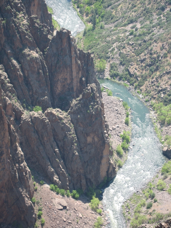 The river and its handiwork
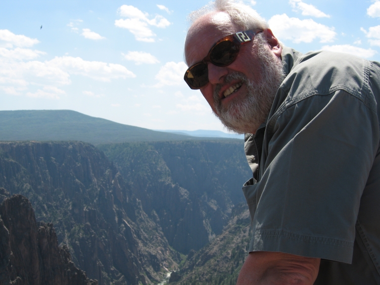 Gerhard leans over an overlook
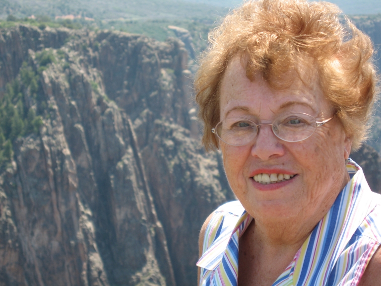 Mom with Canyon
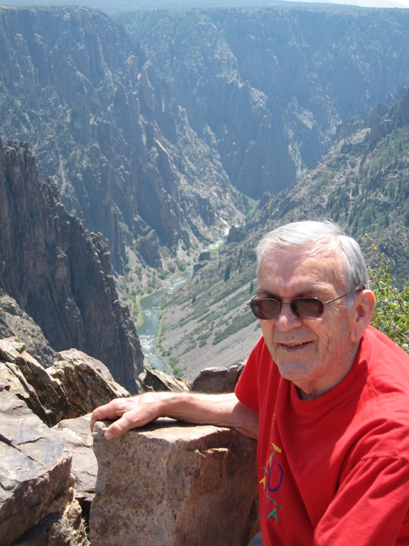 Dad with Canyon
 Chasm View: "Do you feel uneasy gazing into the canyon? The steep walls of Black Canyon range in depth from 2700 feet north of Warner Point to 1750 feet at the Narrows, a short distance upstream from here. The Narrows, between Pulpit rock and Chasm View, is the shallowest and narrowest section in the monument. Here the canyon is less than a quarter-mile across.
The Gunnison River has a very steep gradient. Within the monument, the river has an average fall of 95 feet per mile. This gives the river the energy needed to cut downward faster than other kinds of erosion can widen it. the words of an early surveyor reveal another view of this erosion:
"Hereto was unfolded view after view of the most wonderful, the most thrilling of rock exposures, one vanishing from view only to be replaced by another still imposing. A view which could easily be made into a Scottish Feudal Castle would be followed by another suggesting the wildest parts of imposing height and majestic proportions..." (H.C. Wright, member of the 1882 Byron Bryant railroad survey)." [Above dissertation from another Park Service sign.]
But wait! The Park Service has more!
"Standing here, it is difficult to imagine anhyone trying to cross the canyon or navigate its waters. Like hikers today, the Utes and early explorers faced rigorous hardships.
In 1900, William Torrence led a crew to explore the possibility of diverting Gunnison River water for farming. His first trip ended with the loss of most supplies and a difficult climb to the rim.
torrence set out the next year with A. Lincoln Fellows, with a rubber air mattress. the trip lasted nine days and was not without trouble. At the 'Narrows' the fun began. The Canyon is full of great boulders, which form bridges across the stream. Over these we must scramble, one getting on top and pulling the other up. We spent a day going a quarter of a mile. The walls are almost perpendicular in many places and some 2,000 feet or more to the top."
The Gunnison Diversion Tunnel was completed in 1909, and still provides water to lands around Montrose. Today's river lacks a seasonal variation in water flow and the reduced river is diminished in ability to sculpt the canyon."
And you'd think I'd have enough typing by now (I'm typing the Park Service info from pictures I took of the Park Service signs ...) but here's more info!
"Have you noticed that you are standing on a broad, elevated portion of the earth's crust? This is known as the Gunnison uplift. Perhaps it seems strange that the Gunnison River cuts through the heart of this uplift instead of following an easier course north or south of here. To understand this, we must think back to when the Gunnison uplift first formed.
About 65 million years ago, a large section of hard Precambrian rock, deeply buried by softer sediments, was thrust upward forming a bulge on the earth's surface. This newly formed Gunnison uplift and the Sawatch Range to the east were immediately attacked by erosion. Streams flowed to the north.
As eons passed, the Sawatch Range was greatly eroded. Most of the soft sediments covering the Gunnison uplift were planed off, leaving a broad, flat plain over which streams meandered.
Then, repeated volcanic eruptions deposited layers of rock. Mounainous piles of volcanic debris created what we know as the West Elk Mountains and the San Juan Mountains to the south. Drainage was diverted around the south side of the West Elk Mountains directly across the buried Gunnison uplift."
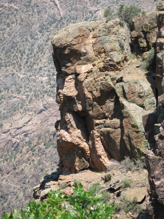 A huge rocky outcropping